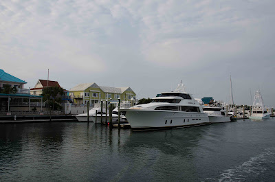
Thursday June 24, 2011

We left the City Dock at Beaufort at 07:50 today and circled Radio Island to bypass the bascule bridge in the Russel Slough that was closed for "morning rush hour". We had our first critter sighting of the day when we saw some of the wild horses on Shackleford Island.


Shortly after Beaufort, we entered the Adams Creek Canal portion of the ICWW.


Along here, we were told we may see some bald eagles but the closest we got were some turkey vultures.


We encountered our first barge traffic in the ICWW canal (other than in major shipping ports), a load of wood chips bound for a paper mill.


We left Adams Creek and headed into the Neuse River which is a fairly open body of water. The smoke from the brush and bog fires really started to get bad again as we passed Oriental NC. At least I think we passed by Oriental which is somewhere in the smoke....

Visibility < 1/2 mile

We got to become accustomed to navigating by GPS and watching the radar for other boats which included some commercial traffic and large yachts.

The "blips" are other boats

Dragging for shrimp

A big "blip"

After about 15 miles of navigating in the smoke on the Neuse, we entered a canal that took us to the Pamlico River. The visibility started to improve. We passed by a shrimp fleet moored near the Hobucken Bridge and we got to see how they processed the day's catch.


The Pamlico River is about 5 miles wide at the point where we crossed it and headed up the Pungo River to Belhaven. The first marina we tried was terrible with rickety docks and not enough room to manoeuvre so be did a quick abort and headed to Dowry Creek Marina, a few miles further along our route.


It was very nice with friendly dock staff who helped Captain Brian execute his first "stern into a slip with pilings" docking manoeuvre. It was very hot and humid again it didn't take us long to get into the refreshing pool.

Our friends, Alec and Sharon from Chocowinity NC, came by to visit. They brought us a gift of some breathing masks as it appears that we have not yet passed the worst of the NC brush and bog fires. Apparently they need a hurricane or tropical storm to extinguish them. We all went out to supper in Belhaven at the Fish Hooks Cafe. Great fresh local seafood!

While we were eating, there a terrific thunderstorm passed by. By the time we looped by the Food Lion for some quick re-provision, it had passed but entertained us with a fantastic lightening show as it passed over Cape Hatteras.

Our cumulative totals:
Distance travelled = 1169.3 nm
Travel Time = 164h 34 m
Fuel Burn = 1081.6 US gal

Wednesday June 23, 2011

We awoke in Swansboro NC to the sounds of a 07:00 artillery barrage from Fort Lejeune, a few miles away. The boat was covered in ash from the nearby brush fires and low lying smoke enshrouded the area.


The engine room had cooled off overnight and Captain Brian spent an hour down below working on troubleshooting the high transmission temperature alarm problem we had encountered yesterday. We finally concluded that we had a bad temperature sensor rather than something wrong with the transmission. We disconnected the defective sensor and proceeded to our destination of Beaufort NC. We found out there are no replacement parts immediately available (6 week delivery) so we will have to do without temperature sensing on one transmission.

Here we are leaving Swansboro.


The first part of the route was along a man-made canal. We then entered Bogue Sound which had a dredged channel with little islands made from the dredged material.


The smoke got worse as we neared Beaufort and visibility reduced to 1/4 mile.


The approach to Beaufort through Moorehead City was a bit tricky with multiple channels and no visibility but were able to get tied up at the Beaufort Town Docks by 13:50.

Approaching Town Docks

Beaufort Waterfront

The smoke started to lift as the sea breeze built through the afternoon and we were able to do a walking tour of the town. The big claim to fame here is that Beaufort was once home to Blackbeard the Pirate.


After our walk we stopped at the local sailor's pub of a cold beer.


We all went out to a really cool restaurant for a "Tapas Style" supper.

Our cumulative totals:
Distance travelled = 1099.8 nm
Travel Time = 156 h 9 m
Fuel Burn = 991.7 USGal

Tuesday June 21, 2011

Summer Solstice Day .....

This morning we left Wrightsville Beach at 07:15 intending on making some good time to get to Beaufort NC.


There was a sandbar that someone had taken ownership of with a Tikki Umbrella and a parking meter.


We got through the Figure Eight Island Bridge at 08:00 and were pressing on to make the Surf City Bridge hourly swing when we had an over temperature alarm on the port gearbox. This required a precautionary shutdown of that engine while we tried to sort out the problem. While moving along on one engine we had our critter sighting of the day .... a giraffe!


We also passed close by some of the channel markers which always have an Osprey nest.


There was also a local brush fire which provided a local overcast sky which kept the heat down for most of the day.

We got to the Surf City Bridge at 11:00 and the New River Inlet by 13:00. This stretch of the ICWW channel passes through a slough-threaded marsh separated from the ocean by barrier beaches. Most of the small waterways dead-end inside the beach dunes.


After Captain Brian spoke with several of the engine service people, we decided to stop at Hammock Bay for an hour or so for lunch and to try to diagnose the gearbox problem. After a half hour in the 120F engine room we still did not have a solution but highly suspected a defective temperature sensor in the gearbox. We decided to press on with one engine to get closer to Beaufort NC where there are major service facilities.

Shortly after leaving Hammock Bay, we encountered Camp Lejeune, a US Marine training facility where they fire live artillery rounds over the ICWW on occasion. Luckily they were practising elsewhere on the base today.


For our neighbours on Bay Berry Dr. .... The US Coast Guard has a vessel named after your street!


One of the local activities we saw today were people harvesting clams by standing in the water with a rake and dropping them into floating nets.


We stopped at Dudley Marine in Swansbourough NC at around 18:00.

The overcast from the humidity and local brush fires curtailed the Summer Solstice sunset.

Our Cumulative Totals:
Distance Travelled = 1075.9 nm
Travel Time = 152 h 34 m

Monday June 20, 2011

 Cape Fear Day .....

We were up in good time this morning at the Myrtle Beach Yacht Club for our trip to Wrightsville Beach.


The weather forecast looked fairly good as we pulled out of the MBYC with only high temperatures and a slight chance of thunder storms in the forecast.


We passed from South Carolina to North Carolina near the Little River Inlet. To the east, there were salt marshes and narrow barrier islands and to the west, some fairly developed areas with golf courses and expensive homes.


 Hole 18 at Glen Dornach

Our critter sighting of the day was a heard of wild goats on an island near the inlet.


After passing Shallotte Inlet, we encountered a fishing fleet at Holden Beach.


Finally, we reached the milestone of 1000 nautical miles! We think we are closing in on half way. The next inlet was Lockwoods Folly. Lots of people out relaxing.


We passed by Southport and entered the Cape Fear River. Here is the lighthouse at Oak Island.


There is a naval base a few miles up the river and we encountered a large US Navy supply ship leaving it's loading base.


An interesting navigational note, when following the ICWW south to north, you keep the red buoys to port. This does not apply when in an inlet such as here. It follows the "red right returning rule". However, they put a little tag on the buoys to indicate their ICWW navigational rule. Note the square on this one which means "treat this as a green buoy for following the ICWW route".


Near the end of our day's trip we passed by the Carolina Beach Inlet. Really beautiful.


We ended our day's trip at Wrightsville Beach at the Seapath Yacht Club. We were given a slip in the face dock which was easy to get into. It was really hot. They set a record high temperature in nearby Wilmington NC at 100F today.

Captain Brian met the person who was cleaning the boat next to us. He offered her the opportunity to do a thorough cleaning of Don't Cha but she had to leave early to feed her horses. She offered to come back tomorrow morning but First Mate Joan said we had to move on.


The Yacht Club had a loaner vehicle and we were able to tour the Wrightsville Beach area and go to the grocery store for provisions.


This was our sunset view tonight.


Sunday June 19, 2011

Father's Day ....

We got underway from the Wacca Wache marina at 08:35 for our cruise up the Redneck Riviera. This part of the Waccamaw River was one of the most scenic from the natural perspective in our opinion. The river winds through moss draped cypress trees.


The Waccamaw River is the colour of tea as can be seen in the photo of our wake. This stains the bow of the boat with a brown moustache.

 Waccamaw River "Tea"

The boat traffic was fairly heavy with numerous "no wake" zones which cut our average speed considerably. Lots of people out enjoying the river in their pontoon boats jet-skis and runabouts. We had one hold up at a low bridge as we approached Myrtle Beach.


The river turned into a man-made canal as we entered Myrtle Beach. Here we got to pass by a few golf courses (one of which I played a few years ago).


We saw a couple of unique solutions for getting golfers across the ICWW channel.

A Private 65 ft Clearance Bridge at the Grand Dunes Resort

 
The Cable Tram at Waterways Golf Club

One had a sign giving us our distance to New York City.


There are also some great new homes along the ICWW to provide some entertaining viewing.


Joan finally got to remove another critter from her sighting punch list. A whale!


The day was very hot and humid with a heat index of 107 F. At around 14:00 the sky started to look a little questionable and given the lack of other places to stop for the next few hours, we pulled into the Myrtle Beach Yacht Club. After returning from the office to register for our slip, the sky looked like this.


Twenty minutes later, this was the view through the windshield as we sat in the dry air-conditioned cockpit.

 After the rain stopped, we managed to take advantage of the Yacht Club's laundry and pool.

Our Trip Cumulative Totals are:


Total Distance Travelled = 971.7 nm
Travel Time = 137 h 11 m